
Timesgar Fm
Type Locality and Naming
Joulia, 1959. Group: In-Azaoua Gr
References: Joulia, 1959; Claret & Tempère, 1968; Valsardieu, 1971; Fabre et al., 1983; Abdoulaye et al., 2007.
Synonym: Timesguar, Timesugar (all misspellings), "Grès de Timesgar", "Grès anisométrique de Timesgar”. Equivalent(s): Possibly the base of the Hasawnah Fm of the Djado Basin
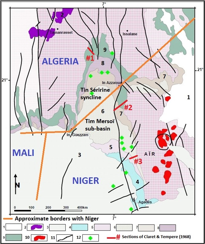
[Figure 1. Map of the Tim Mersoï Sub-Basin and the Tin Séririne syncline showing the locations of the three sections studied by Claret & Tempère (1968) (Source: Map modified from Mammar, 2012)]
Lithology and Thickness
Begins with a thick conglomerate resting on the basement, transitioning to a coarse sandstone, with white clay cement; very gradual transition to the upper layers; numerous beds of fine gravel and argillo-psammitic events. Thickness: 120 m in In Azaoua and 400 m in In Guezzam. The average is 180 m.
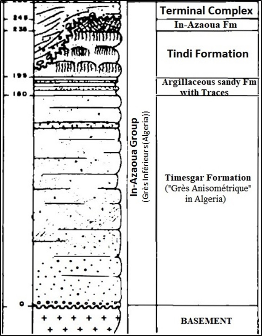
[Figure 2. The complete In-Azaoua Group at Claret & Tempère (1968)’s section #1 location in Algeria (see Fig. 1) (Source: Modified after Claret & Tempère, 1968)]
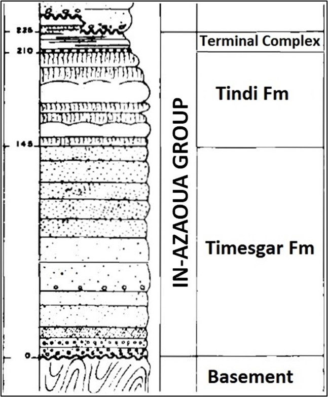
[Figure 3. The In-Azaoua Group at Claret & Tempère (1968)’s section #2 location (see Fig. 1) (Modified after Claret & Tempère, 1968)]
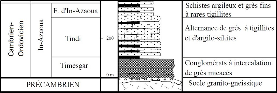
[Figure 4. Sub-division of the Cambrian-Ordovician In-Azaoua Group west of the Aïr Massif between sections #2 and #3 of Claret & Tempère (1968) (Source: Modified after Abdoulaye et al., 2007)]
Relationships and Distribution
Lower contact
Precambrian is below.
Upper contact
Overlying Unit: In Niger, the Tindi Fm; in Algeria, the "Argillaceous Sandy formation with Traces" [See description with In-Azaoua Gr]
Regional extent
GeoJSON
Age
Depositional setting
Marine
Additional Information